This blog is for nonprofit, educational purposes - media is incorporated for educational purposes as outlined in § 107 of the U.S. Copyright Act.

Tuesday, October 24, 2017

Flat Earth Challenge: Estimate Altitude of the International Space Station (ISS)

You can estimate the altitude of the International Space Station (ISS) by measuring the angle to ISS in the sky from two different positions -- however, your observers should not be too far apart or the curvature of the Earth will make your angles more and more unreliable.  You can also use proper spherical trigonometry once you have affirmed to yourself that the Earth is a spheroid (left as an exercise for the reader).

As a Flat Earther, would finding out the International Space Station is actually a couple of hundred miles up change your mind?  If you would consider such evidence, then here is the method.

You need to get two people together and go out and measure it multiple times -- estimate your margin of error (can you even measure to within 1°)?  Think about how you can make your angular measurements more accurate.  Maybe get a surveyor friend with a Theodolite to take more accurate measurements of the angles if you can.

I also posted a shortcut method at the bottom if this is all too much for you.

Practice with airplanes, with some care you can find the exact flight on FlightAware and find out the actual altitude.

Once ready, you can find when the ISS will be over your location using this Tracker:

ISS (ZARYA) - Tracker

You can use this to plan your observation locations and time and it will also tell you exactly where the ISS is overhead so you can compare that to your observational data and check how accurate your measurements were.

You need to record the exact date and time (to the second) that you make the observations from two locations (around 10-20 miles apart), ideally take an image using a theodolite application but you'll need a separate record of the azimuth as phones are notoriously poor at finding the heading.  If you capture some distinctive feature on the ground and line it up in Google Earth you can find the heading much more accurately.

Remember, you need both Azimuth and Altitude from both locations, at the SAME time.  This exercise is not very forgiving.  Azimuth is the compass heading, Altitude is the tilt up.

Here is a School Worksheet that explains how, but as this is slightly complex let's walk through an example (note this is a simulated observation, I had planned to observe one leg but it was cloudy):

Observation Time: 2017-10-19 15:49.09Z,  locations 14,011 meters apart (~8.71 miles)

Location A: 30° 23' 2.40"N,  97° 42' 26.27"W
ISS Az 320° 16' 20.4", Alt 65° 26' 12.6" [320.27233°, 65.43683°]

Location B: 30° 26' 4.70"N,  97° 50' 27.20"W [30.434637°, -97.840887°]
ISS Az 322° 27' 18.0", Alt 67° 2' 1.3" [322.455°, δ=67.03369°]

Below is the geometry from the worksheet, keep in mind this is in 3 dimensions with G being elevated directly over C.


To orient ourselves.  North (0°) is straight up.  Our two locations are points A and B, we know from Google Earth the distance between them (c) is 14,011 meters and the heading from A to B is 293.76°.  C is the point on the ground directly under the ISS (which is at point G, directly over point C).  From (a) and δ (ISS Altitude at B) we can find our final height, f=a·tan(δ) or  f=b·tan(ε)

For our case it looks like this with the two observer ISS Azimuth's drawn in:


From this, I know that (a) is about 107 miles just from measuring on Google Earth, which makes 107*tan(67.03369°) which puts the ISS around 252 miles high.  So we're on the right track.  But let's do the math also.  Before we panic over the math, remember that the tangent of an angle gives us the SLOPE of the line.  SLOPE is RISE/RUN so if we multiply by RUN we're left with just RISE.  That's all this is doing.

Compare the location of ISS on the satflare map with the angular estimate from the Google Map.  They are a good match so we know we have pretty good Alt/Az data for our two locations.


So now we just need to connect the dots.  We can solve any triangle if we have 3 of the six elements (length of sides and angles).  We have (c), and we can find β and γ from the azimuth angles.

From basic triangulation we can then use the law of sines to compute the remaining sides of a triangle when two angles and a side are known.  In the workbook they use π (pi) for the angle at C, but I'm going to use θ (theta) as using π (pi) is confusing since it has another mathematical meaning.

Location A:

Our bearing from A to B is 293.76° and the ISS Azimuth is 320.27233° which makes our angle at A of 26.51233° = β+ɑ

Location B:

The ISS Azimuth here is 322.455° and our reverse bearing is 113.76° gives us an inside angle of (360-322.455) + 113.76 = 151.305° = γ-ɑ

That gives us two angles and a side so we can now solve for side (a) using the Law of Sines.


c/sin(θ) = a/sin(β+ɑ) = b/sin(γ-ɑ)

I let the linked calculator do the work but you can see we get 176637.5m for (a):

176637.5 meters * tan(65.43683°) ~ 395.2 km (246 miles)

And going the other way, from A we get 164219m for (b):

164219 meters * tan(67.03369°) ~ 386.5 km (240 miles)

Somewhere in that range.  The current balloon record is 53km - but that was a total weight of under 40 kg and at 100 km the speed required to maintain flight is greater than the orbital speed (known as the Kármán line).

If you need to estimate the bearing using the latitude and longitude points, where φ₁,λ₁ is the start point, φ₂,λ₂ is the end point you can use:  atan2(sin Δλ ⋅ cos φ₂, cos φ₁ ⋅ sin φ₂ − sin φ₁ ⋅ cos φ₂ ⋅ cos Δλ)

But what is our margin of error here?

Our Azimuth angles are less than 2.2° apart so we clearly have to be fairly accurate.

Let's reduce both our inside angles by 2° which will bring in the sub-ISS point closer and give us an underestimate of the height.  That puts (a) at just 66,409 meters and puts the ISS at 97.3 miles.  If we underestimate the ISS altitude angle by another 2° that leaves us at 88.6 miles.  Still WELL above any balloon nonsense but we get an idea of how much even a small error will affect the final results.

You can get further apart but if you get too far then Earth's curvature starts to mess with your angles.

Shortcut


Also note that while you can't use tan() function for 90° angles, if the ISS is directly overhead one location, you can just use the Altitude angle from the other location and multiply that by the distance between and avoid all the other angle calculations because (a) would equal (c).

If you build up trust in the ISS tracker application you could use this method to make a single observation of the Altitude angle and estimate the height using the calculated distance.

I attempted such a measurement the other day but I missed it!


I was a little annoyed at myself for missing the angle measurement.  It was expected to be at about 71.8° elevation angle in that first frame (2017-10-10 18:57:27) which would put the ISS directly overhead about 78 miles away from me and 78*tan(71.8°) = approx 237 miles up.  And if we add in the Earth curvature of 1.13° (very simple to compute: distance/R gives you radians) over that 78 miles we get an estimate of 254 miles up (actual was 253 miles or 407.3 km).  So accounting for the slight amount of Earth curvature gives us a more accurate altitude figure.... hmmm...

Now, because I didn't get my crosshairs on the ISS I don't have an angle measurement so I'll keep trying (and I think I need something more accurate than a phone).  But the point isn't for ME to prove to myself the ISS is about 250 miles up but for YOU to do the work yourself.

I'll continue to add future observations.

But also think about this.  How is the ISS pretty much where satflare predicted for me and also accurate for all other observers if it isn't going 17,000 mph?  You could fake it for a short distance but then you would soon get WAY off.

Given that it orbits every 90 minutes and it's about 24,900 miles that is AT LEAST 16,000 miles per hour if it was buzzing right over our heads.  That's a mighty fast airplane, much less a balloon.  Do you have any idea how much heat an airplane that fast would generate at MACH 20.8 and how much FUEL that would that?  The Concorde burned 4,800 gallons per hour (22,000 l/h) at cruising speed of Mach 2.04.

And this thing is about a football field in size (356 feet (109 meters) by 240 feet (73 meters)), while the Concorde was just 202 feet long (and you can verify these dimensions once you confirm the distance to the ISS using the methods described herein, because angular size is just 2*atan(size/2/distance).   So if you know the distance and angular size (from a high resolution image) then you can estimate the size.

=============

I got a little bit better observation of the angle here (satflare observation link):

ISS observation 2017-10-29 - See YouTube Video

I don't know how much horizon angle throws off the elevation angle but the expected angle is 58.3 - 58.8° (this is how much the elevation angles changes in ONE second at this time) and we're marking out 58.3° with the ISS just above the center line.

The Horizon Looks Flat? Oh Really?

How much has been written on this subject of the 'Horizon Looks Flat'... never enough it seems, so here is another, building on previous posts and based on answering this YouTube comment:

Flat horizons everywhere I look at every altitude. How many flat horizons does it take to make a sphere? ~desMEGA

How many "Flat Horizons" does it take to make your horizon go 360° around you?  Anyone standing on a peninsula can observe this:

AirPano Caucasus Mountains

How does a "Flat Horizon" manage to curve around you at the same time? You'll laugh that off but you know you cannot explain or address it. If the horizon were TRULY flat it could NOT go all the way around you. It LOOKS FLAT because you are looking at a curve nearly edge on and it happens to fill most of your limited human vision.

Can any Flat Earther honestly address this?


Moving on...

Get yourself a Canon EOS 6D (Full Frame DSLR, 5,472 × 3,648 pixels, ~$1400) and a Canon 11-24mm F/4L lens (~$2700, you can rent these things also) which, at 11mm, has a 126° 5′ field of view and is NOT fisheye (is one of the widest-angle rectilinear lenses on the market). Go up to 40,000 feet and take an image at 11mm with the horizon passing through DEAD CENTER of the lens with NO obstructions of the horizon view (including clouds, meaning you need a very clear/not hazy day). You aren't allowed to PRETEND the horizon extends beyond where you can see it because YOU are the one ASSERTING that you see SEE IT AS FLAT.

You should see approximately 103 pixels of horizon sagitta (the "droop" of the horizon circle as it curves around you).

This version uses a balloon with a curvilinear fisheye lens but this is the METHOD I'm talking about, here the balloon is up higher but we have a much smaller field of view and lower resolution so we only get about 38 pixels, from about 33124 meters.

Flat Earth Insanity: High Altitude Balloon analysis of the Rotaflight Balloon footage
See also: further analysis of location

This distinction between METHOD and CLAIM is something that Flat Earthers seem to have a hard time with.  I'm not saying this PROVES anything -- I'm showing you that you are LIKELY wrong and HOW YOU CAN TEST IT FOR YOURSELF.

However, here is a very simple way to show that the curvature above isn't due to the fisheye lens (NEVERMIND that below lens center the distortion curves straight lines the OPPOSITE WAY than this curvature)... we can compare the same horizon at different altitudes all going through lens center:

Rotaflight at lower-altitude shows nearly flat horizon

Rotaflight at approx 13520 meters,. shows increasing curvature

The keys here are ALTITUDE, HIGH RESOLUTION, and WIDE ANGLE. I show you EXACTLY how to calculate this on a spheroid in my post. In simple terms this "sagitta" is well approximated by the rather astonishingly simple equation:

w × d/R × tan(fov/4)/2

Where 'h' is observer height, 'd' is the distance to the horizon (d=sqrt(h(h+2×R))), 'R' is Earth radius (in same units as 'd'!), 'w' is the width in pixels (assumes square pixels), 'fov' is the field of view in appropriate units for your tan() function (usually radians unless you selected degrees).

At the same time take a water level up and take an image where we can see where the water in the water level matches against the horizon so we can see where LEVEL truly is.

Water level, like so:


You can see my own measurements here with an iPhone app Theodolite where I show that these measurements agree with the Globe model.


You must supply RAW images at full resolution exactly as detailed above (horizon dead center or close to it) and the EXIF data must be 100% intact and unaltered in any way.

So -- is any Flat Earther willing to do the work to demonstrate the horizon curve to themselves? If not, then you are being DISHONEST.

The Flat Earth Gish Gallop

The Gish Gallop is a rhetorical strategy where the person tries to show just how amazingly strong and vast their position is by presenting a litany of arguments all at once, and if you only address 99 out of 100 of them then you get the "AH HA! You can't address how water sticks to a spinning ball!"

From the Rational WIKI

The Gish Gallop should not be confused with the argumentum ad nauseam, in which the same point is repeated many times. In a Gish Gallop, many bullshit points are given all at once.

Indeed - if the Flat Earth argument were strong then ONE demonstration would be enough to destroy the Globe.  But Flat Earth doesn't have even one that will hold up to scrutiny so they would rather throw a bunch of bullshit (technical term) and see what sticks.

One 'Mrs. Butterworth' tried to pull this by proxy in a YouTube comment:


Please.  "usually pretty good" but can't address this utter nonsense?  Not ONE of these is even a technical challenge.  All you need is a dictionary.

This sets off my SOCK PUPPET alarms like crazy, and I called them out on it.  They said they aren't so, Ok fine, it doesn't really matter for my purposes... here we go... [link to my posted reply, included below slightly edited]

First of all, nearly all of this is already covered on my blog:  https://flatearthinsanity.blogspot.com/


"You speak of science and science fact. Then what about the scientific method? Last time I checked, it begins with observation. When was the last time anyone observed the curvature of the Earth, and please don't include fake Nasa cgi cartoons."

Strawman, Misleading, Lies about not making observations, Lies about NASA

We have thousands of observations -- Flat Earthers simply dismiss them without justification to do so and are, apparently, too dumb to do their own tests.  They do FALSE tests and lie.

Here are some collected observations:

http://flatearthinsanity.blogspot.com/2017/06/where-is-curve.html

Soundly has some amazing images & videos.

Wolfie6020 has done a ton of observations.

A new post I just did showing how to access the National Geodetic Survey Database with tens of thousands of direct measurements of the 'curve' in there.  Flat Earthers just wave their hands and ignore it -- which is on them.  They are too dumb to replicate the data so they lose.

This is not an honest argument from flat earthers in the slightest.


"Here's one example that includes scientific evidence: How can you see both the sun and moon in the same sky?"

Strawman, Self-Debunk

That's JUST DUMB -- hold two spheres (representing moon and sun) in front of two different people -- they can both see them.  BIG WHOOP.

Hold up a ping pong ball to the Moon so the terminator (shadow line) is aligned -- They'll match.  That is impossible with a nearby Sun.


"What, people on the other side of the ball get neither?"

That isn't English so I have no idea.  What is the logical fallacy for 'gibberish'?

But on a Flat Earth with a 'nearby' Moon observers far apart should see opposite sides of the Moon and they do not.  And their nonsense "concave moon" EXCUSE doesn't work due to libration of the moon.


"Here's another, why is the moonlight colder in the shade if it reflects the sun's light?"

Lie

It isn't, open sky is colder than covered spaces.  I tested it on a moonless night (negative testing!)

Flat Earthers don't know how to actually test anything.  I call this a Lie because they pretend like they have actually tested it and ruled out all other possibilities -- they haven't.  This asserting it KNOWING you haven't actually tested it is the lie.


"Why is the heliocentric model a theory and not a fact?"

Strawman, Lie

This person is either ignorant or is lying.  Let's define these terms correctly...

A scientific FACT is something directly and repeatedly measured.  If something is 100% measurable it can become a scientific LAW.  Such as the LAW OF GRAVITY.

[by '100% measurable' I meant the measurement is accounted for by the known variables to the margin of error, if you tried to measure human response to some stimuli there are too many unknowns and you won't get a repeatable measurement, even from the same person so while you might get trends you aren't likely to get a LAW]

A scientific THEORY is a well-substantiated explanation of some aspect of the natural world, based on a body of FACTS that have been repeatedly confirmed through observation and experiment.

LAWS do not become THEORIES -- EVER.  They are different categories.  A scientific THEORY IS the highest form of knowledge in science.

A scientific MODEL is a "testable idea".  The heliocentric MODEL has been tested and confirmed billions of times.  Flat Earthers have NEVER demonstrate that it is false.  Period.

Flat Earth has been tested and FAILED... over and over.  Flat Earth liars make excuses for their failures or ignore them.


"Why is gravity a theory and not a fact?"

Strawman

There are both a LAW OF GRAVITY (what we measure) and a THEORY OF GRAVITY (relativity says that spacetime determines how matter moves and matter tells spacetime how to bend).  Relativity COULD be wrong -- but since EVERY measurement to date conforms to Relativity and it made Astonishing predictions that have held up it is THE BEST model of gravity we have.

Furthermore I explain why the utterly puerile "density" claim that Flat Earthers push is WRONG in "Oh Buoyancy!"


"Why is evolution a theory and not a fact?"

Strawman

There is the FACT OF EVOLUTION (evolution observed happening) and the THEORY OF EVOLUTION (that it is driven by Natural Selection).  Look up 'Creationists Claims' for further debunking of this BS.


"Why is the big bang, an explosion that created everything but destroyed nothing, a theory and not a fact?"

Strawman

Big Bang wasn't an explosion.


"Why can you not soak a tennis ball with water, have it spin even 1 mph, and not have the water fly off?"

Strawman, Lie

#1 Because it's an utterly bogus and false test.  The tennis ball is subject to Earth's gravity while lacking sufficent mass of it's own.
#2 the water does NOT fly off an equivaliently rotating tennis ball -- SOME WATER does but proportionally a greater thickness of water remains on the tennis ball than exists on Earth.


"Why does the coriolis effect have no influence on airplanes?"

Lie

 It does, it is very small.  Similarly, airplanes DO have to pitch over as they fly, it's called holding altitude / keeping vertical airspeed near zero.


"Why is Nasa run by freemasons wherein the challenger explosion was a hoax, not to mention the fake Apollo missions?"

Assertion -- claims not evidenced


"Why do they shove this shit in our faces in movies, television, and music?"

Appeal to Emotion

Are you a child?   (would be my response)


"Why haven't you woken up?"

Ad hominem

Apparently 'woke' means 'moron' now.  Ad hominem back at ya.


A few questions back to Flat Earth:

How does Flat Earth have TWO different equatorial circumferences?

Why can't flat earth locate Polaris?

Curve found again

and again

and again

Flat Earth fails at perspective


In summary, every one of their arguments wasn't just wrong, it was vapid, puerile, and evidenced a profound level of ignorance on their part, as well as a heavy dose of dishonesty.

Unfortunately, it takes ten times the effort to dispel some uneducated verbal vomit than it does to state something so vapid and pointless (see Brandolini's Law - or maybe it should be credited to Uriel Fanelli?).  And it's even worse if the third parties in question don't have the background to debunk something themselves.  I cannot overcome a lifetime of indifference to knowledge in a few sentences.  The reader has to WANT to learn the reasons why the Flat Earth arguments wrong.

It makes me WEEP for the state of education in our world in the supposed 21st century, there were better educated people in the BCE era!

Flat Earthers CLAIM to want to know the Truth but they sure do not evidence it in their argumentation.

Monday, October 23, 2017

Flat Earth Follies: Survey Says...

This time around we're going to look at some data using the National Geodetic Survey Data Explorer.

I'm just going to pull up some Geodetic Survey marker data for markers lying very near the ocean and we're going to see what shape it describes.  You can see the Ortho Height for each marker is under 2 meters.

Click on the link in the caption for each image to pull up the raw NGS datasheet on each one.

Our first target is down in the very tip of Texas near Port Isabel...

NGS DP0739
In this case we find the NAD 83 XYZ coordinates from the datasheet are:

DP0739 NAD 83(2011) X -   -716,721.076 (meters) COMP 
DP0739 NAD 83(2011) Y - -5,688,867.995 (meters) COMP 
DP0739 NAD 83(2011) Z -  2,784,100.512 (meters) COMP

Next stop is New Orleans...

NGS BJ1342
Where we find BJ1342 at these coordinates:

BJ1342  NAD 83(2011) X  -    -10,884.151 (meters)  COMP
BJ1342  NAD 83(2011) Y  - -5,526,738.137 (meters)  COMP
BJ1342  NAD 83(2011) Z  -  3,172,935.167 (meters)  COMP

And finally we're going to over to Miami, Florida for AA5493:

NGS AA5493

at these coordinates:

AA5493  NAD 83(2011) X  -    983,140.199 (meters)  COMP
AA5493  NAD 83(2011) Y  - -5,664,838.225 (meters)  COMP
AA5493  NAD 83(2011) Z  -  2,751,785.275 (meters)  COMP

So now we can look at these coordinates and see what "level" might be (and you can pull them up yourself and verify my information).

Note: we're only looking at the rough coordinates - there is additional data such how the surface of the Earth has moved over time (for example due to earthquakes, see HTDP solutions) that would be required for exacting measurements - but we're looking at markers that are about 1058 miles apart so a few inches of movement wouldn't make any difference.
See FAQs on 'DATUMS AND DATUM TRANSFORMATIONS'

So let's drop these into GeoGeobra and plot out our markers.

First, Earth is roughly an ellipsoidal surface defined by WGS-84 as having axes 6378137 meters by 6356752.3 meters (aka, oblate spheroid) so we can input this:

a=Surface(6378.137cos(u)cos(v),6378.137sin(u)cos(v),6356.7523sin(v),u,0,2π,v,0,2π)

In my example I've shaved off some unused portion of the ellipsoid to make rendering faster by dropping the 2 out of the 2π's but make sure the portion you need is included or just include the whole surface as above.

Next, we create our points:

A=Point({-716.721076,-5688.867995,2784.100512})

B=Point({-10.884151, -5526.738137, 3172.935167})

C=Point({983.140199, -5664.838225, 2751.85275})

And we can draw some line segments between them:

Segment(A,B)

Segment(B,C)

And our result we can see are well fit to the Earth model.

GeoGebra 3D plot of our three survey points on Earth ellipsoid
So now you have a massive database of actual measurements of Earth's curvature at your fingertips.

Friday, October 13, 2017

Deconstructed - Auguste Piccard: “It seemed a flat disk with upturned edge”

Deconstructed - Auguste Piccard: “It seemed a flat disk with upturned edge”

Is it possible he means it looked like an upturned disk?  As in, you see a bit of horizon curvature?

Stratobowl image from 1935

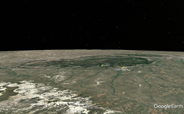
The human eye has a wide field of view so you see a bit more of the Horizon Circle than most images and thus more curvature, all else being equal. One reason for this is that this is NOT the "curvature of the Earth" -- this is the curvature of the Horizon Sagitta viewed nearly on edge.  This is a mistake I constantly see people making.  So it's not a circle of 3959 miles diameter that curved downward, but an OVAL that you are in the middle of with, in this case, a 300 mile radius and viewed on edge at a 4.8° angle -- and this oval curves 360° around YOU.

As to why it looks flat, it's because the terrain is far away and the curvature is fairly slight and you're looking down on it.  We just cannot see the geometry under these conditions.  You can't even see the giant hills and valley's of the Dakota's in Steven and Anderson's image.

Google Earth view from 14mi

The elevation variation across just the Black Hills area is about 3700 feet and you can't see ANY of it.  It "looks flat" because it should.  But where the features are located and how far we can see are the unmistakable markings of a Globe.

How far back is this speaker tilted?


How much are these two images of this building tilted?


If you cannot measure these tilts how do you think you can see the shape in patterned ground from 100's of miles away to see a small change in the terrain that is Earth's curvature?

Curvature on Parade: The Turning Torso video by Mathias Kp

This is a really nice video of a building called the Turning Torso done by Mathias Kp, complete with GPS stamps at different distances (slightly different heights but generally around 3 meters).


He's also got the images stored in flickr so you can download them and he has some nice overlays and analysis already done (including one that looks at possible refraction coefficient in each shot).  I took one and added some additional analysis to it, I assumed a fixed refraction for this analysis because all the buildings are scaled to match the first one.

I took the image with nearly the whole building and used the visible section to estimate the number of pixels per meter.  This gives me a rough way to convert the Hidden Height values to pixels so we can see about where the bottom of the building would be and see how those match up -- it's not perfect, but since the building is very vertical and the distances are large the error is fairly small.

I calculated the estimated Height of Distant Object Hidden for each Observer Height and Distance recorded using an estimated 20% refraction using my FEI calculator.

Unsurprisingly, the results show that the missing height of the building estimated puts the bottom of the building in a fairly consistent location.


Thursday, October 12, 2017

Flat Earth Follies: Magic Fish-Eye Holes in Airplane Windows

The Hilarious Claim (showing very poor reading comprehension)


In response to @turner_d posting this image to show that airplane windows limit your field of view which makes it harder to see any curvature at altitude:

Figure 1

This guy posts the AIRPLANE WINDOW HOLE nonsense!


Reality


Read that again carefully... to explain why we CANNOT see curvature from airplanes the Flat Earther says it's because the window is a fish-eye lens...

Let me rephrase as a positive statement:  You COULD see the curvature but the magic window hole makes it a fish-eye lens.

Ok, I know that isn't what he MEANT, but that is what he said because he didn't bother to read or try to comprehend what David had said.

More Reality


As explained in US5988566A the purpose of the hole is to allow the pressurized cabin to primarily put force on the outermost pane of glass first.  Should the outer pane break the next pane will hold and not allow rapid cabin depressurization (the tiny hole isn't going to leak much).  It's a super cheap way to make sure the outside pane breaks first by unloading the inner pane.

I'm always amazed at the STUPID crap these people come up with.

Figure 2. Ridiculous Flat Earth lies

If they want to create a magic "lens" window to deceive everyone they would not put in this inlet port and instead control the pressure between the outer and middle panes.  This claim is stupid on the face of it.

Oh yeah, Flat Earth'ers are also liars who changed the labels on the original diagram too:

Figure 3. original diagram exposing Flat Earth lies

Meme Version


Quick Post: Explorer II, 1935 High Altitude Balloon flown by Stevens and Anderson, first image from the Stratosphere

On the 11th of November 1935, over the skies of South Dakota, a new altitude record of 72,395 feet would be set in High Altitude ballooning and photography by Stevens and Anderson flying the Helium filled Explorer II.

The first Explorer balloon used the more efficient and more dangerous Hydrogen, the fabric tore, and the balloon burst into flames with the two passengers narrowly escaping via parachutes.

This was the first High Altitude flight to feature a camera.

First photograph clearly showing Earth's Horizon sagitta curvature. [src]
From its vantage point 72,395 feet in the air, the highest point ever reached by man, the camera registers the horizon 330 miles away, sweeping like a great arch across the photograph. The straight black line ruled across the top brings out the curvature of the Earth.

The first few seconds of this video shows some of the video footage they recorded (unmarked up):


British Pathé footage:


Book on early ballooning with lots more detail and information on many flights:

The Pre-Astronauts: Manned Ballooning on the Threshold of Space

Wednesday, October 11, 2017

OH Buoyancy! Flerfers are at it again

OH Buoyancy!


There are 100's more of these -- many of them exact duplicates across numerous accounts which makes me suspicious... but on to the science.

So how does a force that pulls everything towards the center of the Earth manage to push lighter things up?

tl;dr version of Archimedesprinciple


Cut a small hole in the bottom of a bucket
Feed a string through, tie it to a small ball
Fill bucket with BBs
Pull string really hard
Observe that the BBs rise as the ball burrows down, displacing the BBs
Pulling the string applied greater FORCE to the Ball than the BBs


A little bit more science G


First of all, the gravitational force on every molecule is F=m*'g' -- since 'g' is basically the same for all matter near Earth's surface this means that the F -- or FORCE, is proportional to the MASS of that object, times 'g' which is the effective acceleration of gravity at Earth's surface or roughly 9.8m/s².

This follows directly from the more general equation: F = G×m×m/r² where we know one of the masses is Earth (5.972 × 10²⁴ kg) and the distance [r] is 3959 miles (6371393 meters), which just leaves the familiar F=m*g from simple algebra:

F = G×m×m/r² = m×G×m/r²
-- so we can solve G×m/r²
F = m × [(6.67408 × 10⁻¹¹ m³ kg⁻¹ s⁻²) × (5.972 × 10²⁴ kg)  / (6371393 m)²]
F = m × [9.818 m/s²]

So the force (F) pulling down each individual water molecule is actually extremely small, and the force is only slightly greater on an insect (rigid bodies share the force more than fluids so we can say the insect feels the combined force, as we do).  Sure, the total force over all the water molecules on Earth is a lot of Force combined - but that isn't what Gravity is doing in the scientific model -- that is only in the uneducated brains of Flat Earthers because they don't understand the difference between an acceleration (which is roughly the same for all objects) and the force (which is proportional to the mass of that object).

What often isn't stated clearly is that 'g' is not a constant but is a local value, a simplification.  Since 'r' is large even an airplane at 10km doesn't change the value much [9.788 m/s²].  You can watch this change in action in Wolfie6020's video.  So when you change the distance the value of 'g' changes, even here on Earth.


Get on with it already


In a medium where the molecules are (fairly) free to move around, like water or the air (usually called a 'fluid'), everything is competing for that space at the bottom. This gives rise (pun!) to Archimedes' Principle which says that there is a force counter to the acceleration of gravity on a submerged object that is equal to the weight of the fluid displaced by the object.


In our bucket-of-BBs example the Ball displaced some volume (V) of the BBs, which also had some density (p), so the total mass displaced would be the volume (V) times the density (p).  But since we need weight we also have to multiply that times the acceleration, in this case the acceleration of gravity, or 'g'.

If you try to submerge a 24-inch beach ball in a pool you can feel just how tremendous that force can be, it would have a volume of about 31 1/3 gallons or 261.5 pounds [1163.2 N] of water displaced.

So putting that into mathematically terms is very straight-forward:

Buoyant Force = WeightDisplaced
Buoyant Force = MassDisplaced × accelerationOfGravity
Buoyant Force = (DensityofFluid × DisplacedVolume) × accelerationOfGravity

Also written: Bf = p × × g

If that Buoyant Force is greater than gravity then the thing will go up until this force is is equalized -- and it will go down so long as gravity is the greater force.

Imagine that you have a jar of water with a ping pong ball floating on the water. And you allow the Jar to free fall. What happens to the ball? If DENSITY alone explained the buoyant force then it should still float, but it doesn't - the buoyant force drops to zero because we have taken away the acceleration so 'g' becomes zero and p×V×0 = 0


And we know this acceleration changes things in other ways -- this is how a centrifuge works for example, it increases the acceleration factor which increases the buoyant force.

So my question to someone wishing to disprove this, do you have any compelling evidence that buoyancy works without an acceleration or that such an acceleration just happens to magically exist but isn't what we call 'gravity'?

Flat Earthers like to say that 'Gravity doesn't exist' and in a sense they are right.  At least in the sense that gravity works like no other force.  If I apply any other kind of force to my phone the accelerometers will register an acceleration.  But, if instead, I drop my phone and let it free fall, I can very clearly watch it accelerate towards the ground at 9.8m/s² (I needed my phone to film, so this is a ball, obviously):


while that same accelerometer will show as zero acceleration:

Figure 1. iPhone 7 Plus in Free Fall from ~3.4s to 3.95s


This is why Einstein said that gravity doesn't exist and is instead the geometry of spacetime itself.

Meanwhile, my phone sitting on my desk is recording a 1G acceleration upwards because that is the force of the table pushing it up against gravity. So the entire WAY gravity works is different from every other force.

Here is another good video showing that 'density' doesn't do anything in free fall:


So that about wraps it up for this Flat Earth myth.

I welcome any proof that the felt force of gravity is not proportional to the mass.

You can scream 'flefuoyancy' all you want but that isn't evidence or proof.  You'd have to show me a fairly conclusive experiment that shows the well-documented, well-tested model is wrong.

Tuesday, October 10, 2017

Rob Skiba's Second Balloon Launch - Image Analysis at 95,733 feet

Rob Skiba's Second Balloon Launch - Image Analysis at 95,733 feet (29179 meters)

I've been vaguely aware of this for a while but I haven't really had a chance to go look at it before now:


I gotta say, huge thanks to Rob Skiba for proving the Earth is a globe -- so I'm going to keep this one fairly short and simple.

It's a shame that they didn't use something like the Canon 11mm lens on a real camera (126° FOV!) -- but we will have to make do with their tiny 47° Field of View 7.2mm GoPro "non-fish-eye lens".

So around 1:48:30 in the video we are treated with the following view from 95,733 feet up -- according to Rob Skiba and friends:

Figure 1. Rob Skiba YouTube video circa 1:48:30

There is very clearly about 10 pixels of what I call the 'apparent horizon Sagitta'.  The horizon is curved, it matches what we expect on a Globe of approximately 3959 miles radius.

Flat Earth is DONE... Right? (LOL if you think Flat Earthers will believe their OWN evidence you are INSANE!)

But WHY would we expect this on the Globe?

If you recall back from my post describing what the Horizon IS, it is a circle formed where your line-of-sight hits tangent to the Spheroid of the Earth -- aside from terrain differences (almost irrelevant from this high up unless you are looking at high mountains) it is roughly equidistant from you all the way around.

This example figure would be a height of roughly a thousand miles up and the Green Circle would be the horizon.  If the Earth were smooth you wouldn't be able to see any of the Earth past this circle (but mountains and tall buildings can stick up past it).

So the Apparent Sagitta here is a small section of this arc being viewed nearly on edge (a true Sagitta is the arc formed by a chord on a circle, I call this "Apparent Sagitta" because we're viewing it sharply rotated).

You can also see how this works in Walter Bislin's Horizon rendering tool, which will we revisit below.

Figure 2. Horizon geometry

Since your height here in a balloon, even at 100k feet, is VERY SMALL.  For comparison here is the view from the ISS, 400 kilometers up.

Figure 3. Horizon to Scale for ISS (4x higher than this balloon)

Here is what we get from Walter Bislin's site for 29179 meters and a 47° field of view:


Figure 4. Walter Bislin's Horizon Rendering


And here is the overlay with Rob Skiba's video -- an incredible match for all that "fake Globe math"?

Figure 5. Overlay of Rob Skiba video with Walter Bislin's horizon

Conclusion:

So this is pretty much EXACTLY the amount of horizon droop (or Apparent Sagitta) we would expect on the Globe.


See Also:

Sly Sparkane's analysis video, which covers Skiba's first Balloon launch which they apparently lost.


Teme Wilson also did an Earth rendering in Blender to compare the horizon:

Monday, October 9, 2017

Flat Earth Follies: Nikon P900 Superzoom: FLAT EARTH PROVEN- Superdome Seen From 26.55 Miles Away

The claim:

The "evidence":

A blurry white splotch in a shitty P900 video:

Figure 1. I'm pretty sure I see bigfoot in this image (why is all their evidence blurry?)
Wow, that's pretty incontrovertible, I can see why Flat Earthers immediately scream "FLAT!"

Figure 2. Google Earth Eagle's Eye View - 26.45 miles

I get 26.45 miles (139656 feet), but ok.  But that's a LOT of city missing to get to the Superdome.

Here is what our skyline should look like from this angle, according to Google Earth.

Figure 3. Skyline From This Viewpoint

Let's sketch out the skyline from the video in this frame:


And now we can scale and overlay our skyline


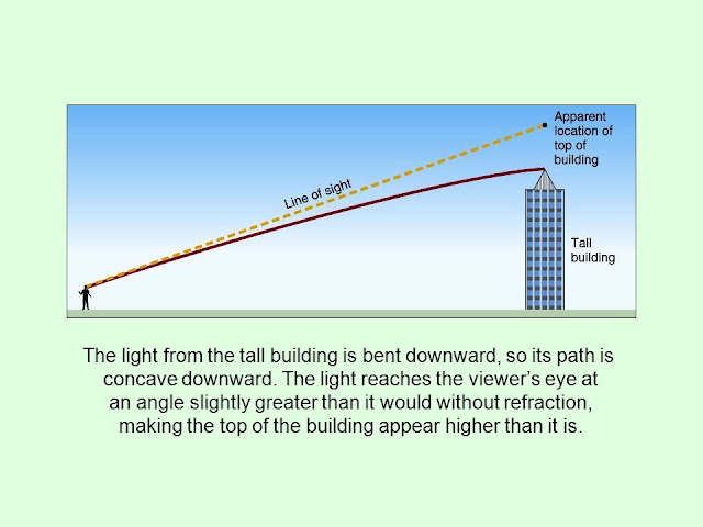
The Superdome is 253 feet high so yeah, refraction would be required to bend light towards the Earth because it is, generally speaking, more dense.


I freely admit that without refraction you wouldn't be able to see the Superdome from here -- but we DO have an atmosphere and it varies in density vertically and this causes Refraction.

If you could see the BASE of the buildings along Lake Pontchartrain then I would be worried, but Flat Earth is missing 100's of feet with no possible explanation -- Refraction bends light downwards which accounts for being able to see further than expected.

What you need to do is take time lapse videos of this view and see how the Refraction varies with conditions, that would give you a better.

If you want to TRY to estimate this with Refraction you can use ATY's 'Calculating Altitudes of Distant Objects'.  I can only throw sample values at this because I don't know the conditions at the time of observation.

For Observer at 82°F, Height 5 feet, 1°C/km lapse rate, Target Height 250 feet we get 2.86 minutes of arc which is about 117 feet of deflection at 139656 feet.

Which makes it effectively 253+117=370 feet -- the video suggests refraction was perhaps slightly greater than this but not by much because that's about what we see.

The "dome" is extremely flattened in this video also, so there are likely other refractive effects between the viewer and the dome.